Actionable Intelligence
For Your Job Site
We transform raw site data into critical insights that save you time, reduce costs, and enhance safety.
Data-Driven Solutions
From groundbreaking to handover, we provide the critical data you need at every phase of your project.
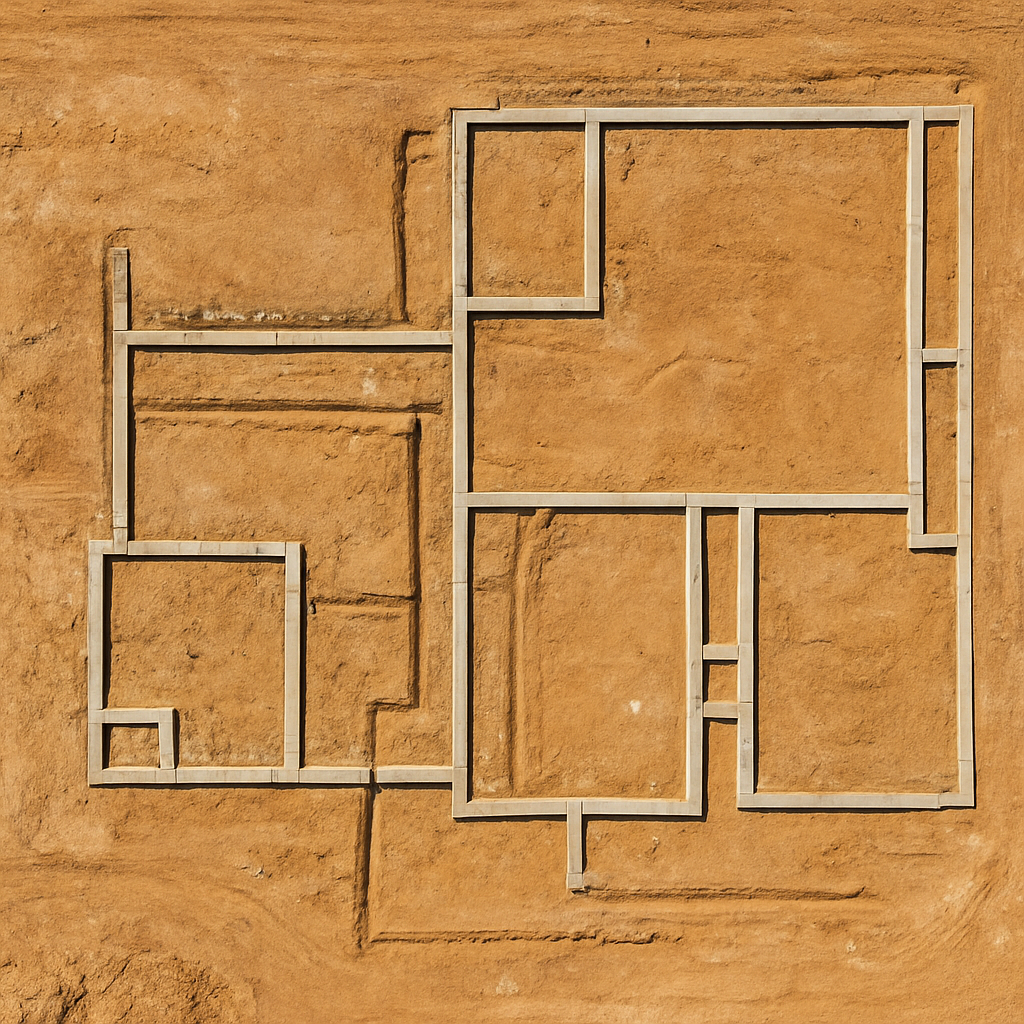
Gain Total Site Awareness
Our high-resolution 2D orthomosaic maps provide a survey-grade, top-down view of your entire site. Measure distances, calculate areas, and plan logistics with unparalleled accuracy before breaking ground.
- Establish accurate pre-construction conditions.
- Optimize site layout and equipment placement.
Keep Stakeholders Aligned
Provide undeniable proof of progress. Our consistent aerial photos and videos create a visual timeline, keeping clients, investors, and remote teams perfectly in sync and demonstrating tangible results.
- Verify that work is completed to spec and on schedule.
- Create a definitive visual record for dispute resolution.
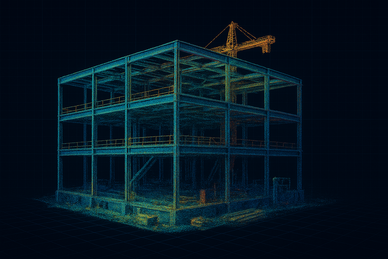
Prevent Costly Rework
Our 3D models and point clouds allow you to compare as-built conditions to your design files (BIM/CAD). Catch discrepancies early before they become expensive problems and accurately track earthwork with volumetric measurements.
- Integrate directly into Autodesk, Procore, and more.
- Accurately measure stockpile and cut/fill volumes.
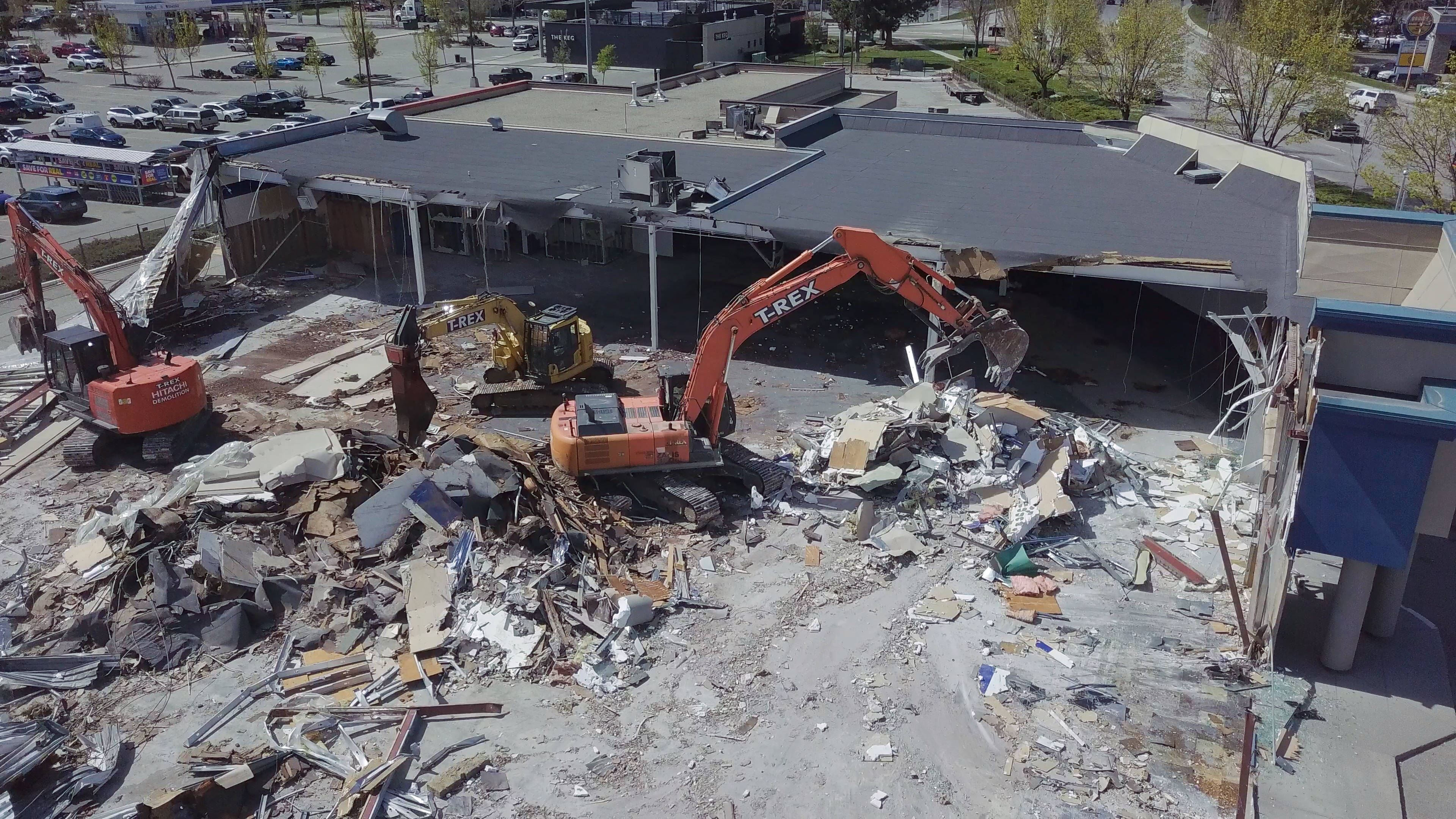
Enhance Job Site Safety
Safely inspect building facades, scaffolding, rooftops, and other hard-to-reach areas without putting personnel at risk. Identify potential issues from a distance and reduce the need for costly equipment like lifts or scaffolding for routine checks.
- Document site conditions for safety and compliance reporting.
- Reduce risks associated with working at heights.

From Data to Decision
We provide industry-standard deliverables that integrate directly into your workflow, turning complex data into clear, actionable insights.
2D Orthomosaic Maps
High-resolution, georeferenced site maps for accurate measurements and planning.
3D Point Clouds & Models
Detailed models for as-built verification and integration into BIM/CAD software.
Inspection & Progress Reports
Clear, concise PDF reports with annotated photos and data for easy sharing.
The DispatchVisuals Advantage
We're more than just pilots. We're your dedicated aerial data partner.
Improve Job Site Safety
Minimize risks for your crew by inspecting structures from a safe distance and reducing the need for manual surveys in hazardous areas.
Prevent Costly Rework
Catch discrepancies early by overlaying drone data onto design plans, ensuring work is completed to spec before it becomes a major expense.
Enhance Communication
Provide clear, intuitive visual data that keeps clients, investors, and team members informed and aligned, reducing misunderstandings.
Keep Your Project On Track & On Budget
Ready to leverage aerial data on your next project? Contact us for a free consultation and a detailed quote.
Get In Touch Today